


Monte Nieddu and Pitrisconi

Rio Pitrisconi Waterfalls near San Teodoro: How to Get There and What to See
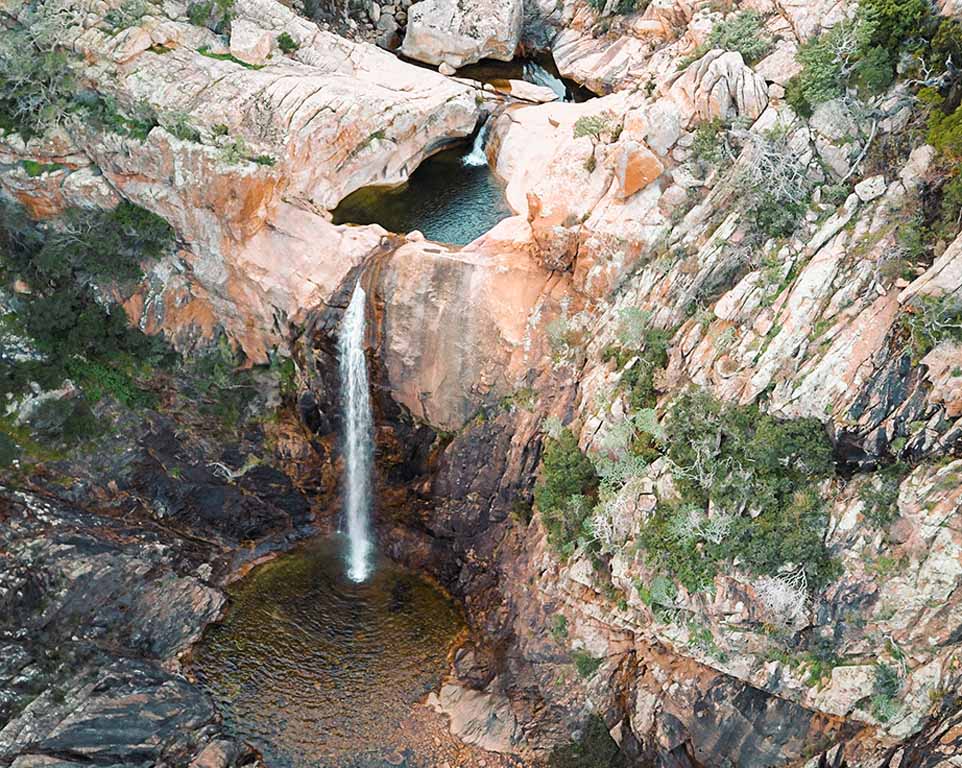
Between San Teodoro and Padru, the Rio Pitrisconi winds through the granite landscape of Monte Nieddu, forming waterfalls and natural pools. You can hike to the falls from Sos Pantamos on the Padru side or approach from San Teodoro via the unpaved Via Aresula. If you’d like to explore further, there are two loop hikes. One follows the stream to the Pitriolu pool, while the other climbs to viewpoints overlooking the coast.
📍 How to get to the Rio Pitrisconi waterfalls
🚙 From San Teodoro via Via Aresula
From the Straulas and Budditogliu area, follow Via Aresula towards Monte Nieddu. The road becomes an unpaved mountain track leading to the area around Stazzo Pitrisconi, where you continue on foot to the first waterfalls. You’ll need a vehicle with enough ground clearance for the rough track. Park only in designated areas.
🥾 From Padru on foot via Sos Pantamos
The trail starts at Sos Pantamos, about 8 km from Padru. Allow around 1 hour and 30 minutes to walk to the waterfalls, not including the return journey or either loop hike.
🕒 Opening hours and access restrictions
Until 31 December 2026, the Municipality of San Teodoro allows visitors to enter the Monte Nieddu area between 8:00 a.m. and 8:00 p.m. Access is prohibited during weather or wildfire alerts. Before setting out, check for updates and find the parking map in the Municipality of San Teodoro’s notice.
🗺️ Hiking on Monte Nieddu: Which loop should you choose?
| Route | Distance | Elevation gain | Difficulty | Highlights |
|---|---|---|---|---|
| 🟢 Pitrisconi pools and waterfalls | 5.2 km | 550 m | EE | Pitrisconi waterfall, a granite grotto and the Pitriolu pool |
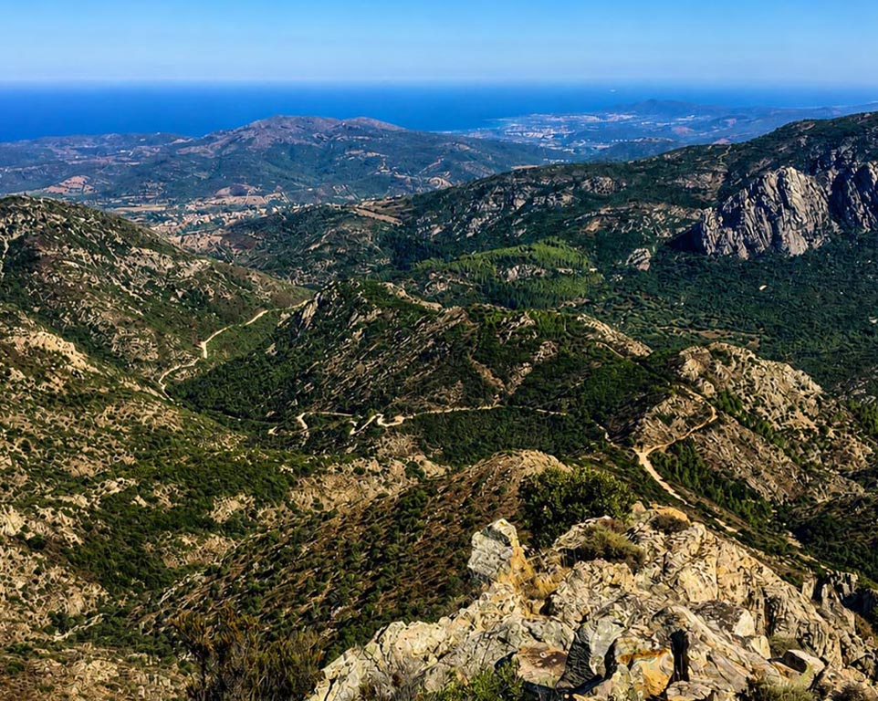
| 🟠 Punta Casteddacciu and Pala di Monti | 6.6 km | 560 m | EE | Views of San Teodoro, Tavolara and the Gulf of Olbia |
The colours match the routes on the map. Both loops are rated EE, the Italian hiking grade for experienced hikers. The waterfall loop is shorter but includes stream crossings and steep sections. Choose the second loop if you’d rather hike higher up and take in views of the coast.
🟢 1. Rio Pitrisconi Pools and Waterfalls Loop
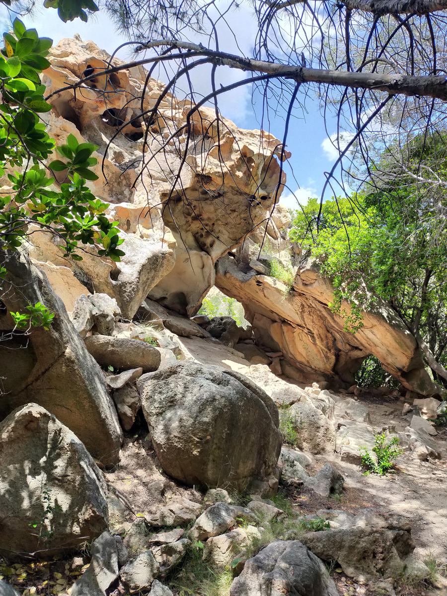
From Stazzo Pitrisconi, head south to the first stream crossing. A short way beyond the far bank, you’ll see a natural pool on your right. Before you reach the main waterfall, take the trail that branches uphill. After about ten minutes of steep climbing, you’ll pass through a tafone, a natural hollow in the granite, before descending to a trail junction.
From the junction, a particularly steep descent leads to the Pitriolu natural pool, where a waterfall drops between the rock walls.
⚠️ Do not use the ropes on the right bank beside the waterfall. They are there for emergency exits during canyoning and are not part of the hiking route.
To continue, climb back to the junction and take the trail heading downstream. Follow the dirt track to the end, then take the path on the left to the second stream crossing. From there, the final climb takes you up the left bank of the Rio Pitrisconi, with views down over the pools before you return to Stazzo Pitrisconi.
📥 Pitrisconi pools and waterfalls loop KMZ track – archived link
🟠 2. Punta Casteddacciu and Pala di Monti Loop
The trail starts a few hundred metres before Stazzo Pitrisconi, at the sign for Punta Casteddacciu (coordinates 40.75385, 9.59153). The climb through Mediterranean scrub takes about 35 minutes to reach the 828-metre summit. From here, you can see the Lerno and Padru valleys and the coast around Santa Lucia and San Teodoro.
Return to the junction and take the left fork towards the Pala di Monti lookout, at 615 metres. From the lookout, you can see Tavolara, Molara, the Gulf of Olbia, Cala Brandinchi and Capo Coda Cavallo. Follow the dirt road from the lookout back towards the starting point.
📥 Punta Casteddacciu and Pala di Monti loop KMZ track – archived link
🗺️ Mappa dei sentieri di Monte Nieddu
🟢 Verde — Anello delle piscine e delle cascate di Rio Pitrisconi
🟠 Arancione — Anello di Punta Casteddacciu e Pala di Monti
ℹ️ Trail information
📍 Location: Monte Nieddu, San Teodoro. An alternative approach starts at Sos Pantamos on the Padru side.
🚩 Start and finish: Stazzo Pitrisconi
🌿 Highlights: Waterfalls, natural pools and a tafone, a naturally formed hollow in the granite
🥾 Distance: 5.2 km
⛰️ Elevation gain: 550 m
🕒 Hiking time: Varies depending on the group’s pace, breaks and stream conditions. The approach from Sos Pantamos takes about 1 hour and 30 minutes one way and is not part of the loop.
⚠️ Difficulty: EE – Italian trail grade for experienced hikers
🔁 Route type: Loop hike with two stream crossings and steep sections
🪨 Terrain: Rocky paths, unpaved tracks and granite surfaces that can be slippery when wet
🧭 Navigation: Follow the green route on the map. Download the KMZ track before setting out so you can use it offline.
📞 Contact details
📧 Email: thinkingsardinia@gmail.com
📱 Mobile / WhatsApp: +39 333 689 8146